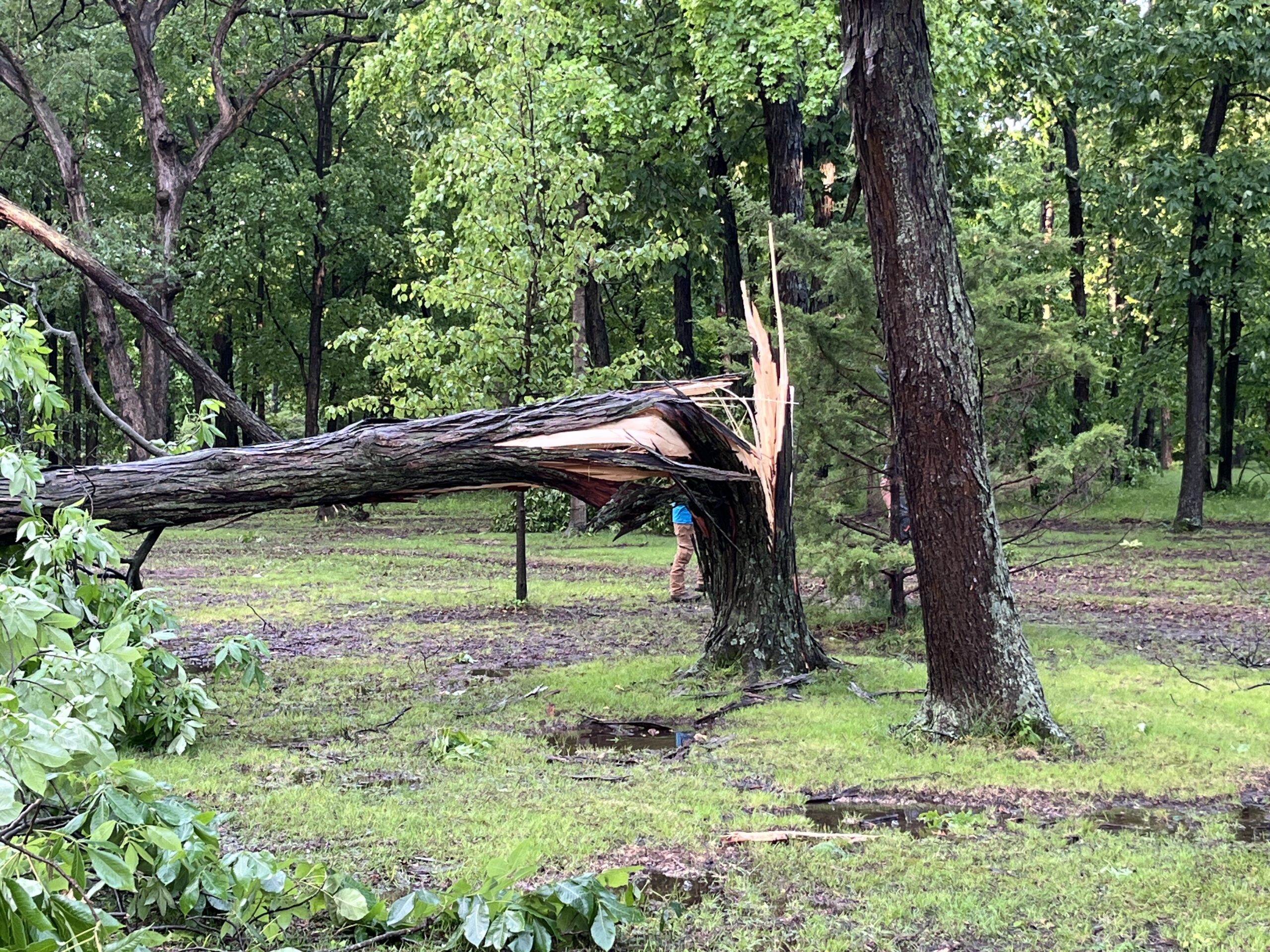
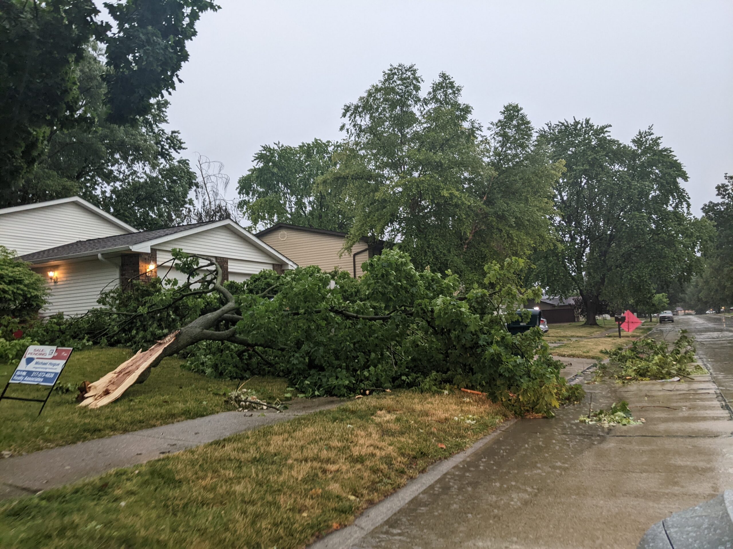
PHOTOS: Storm snaps trees and utility poles in Vermilion County
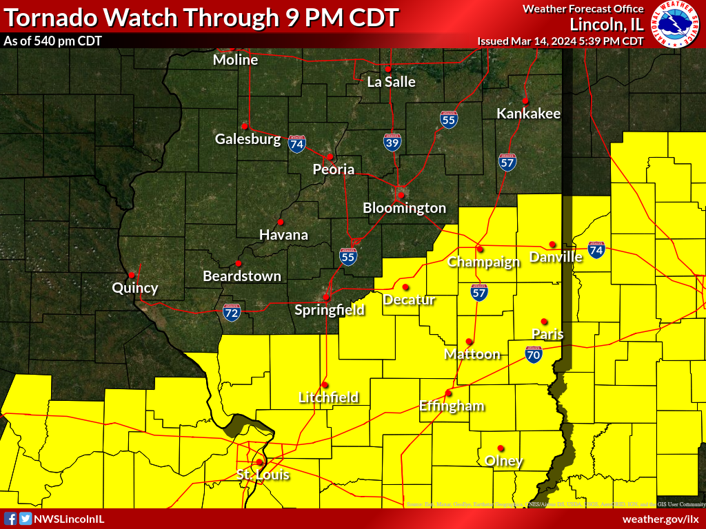
Tornado warnings were issued at different times Tuesday afternoon in Champaign, De Witt, Macon, Piatt and Vermilion counties.


Tornado warnings were issued at different times Tuesday afternoon in Champaign, De Witt, Macon, Piatt and Vermilion counties.
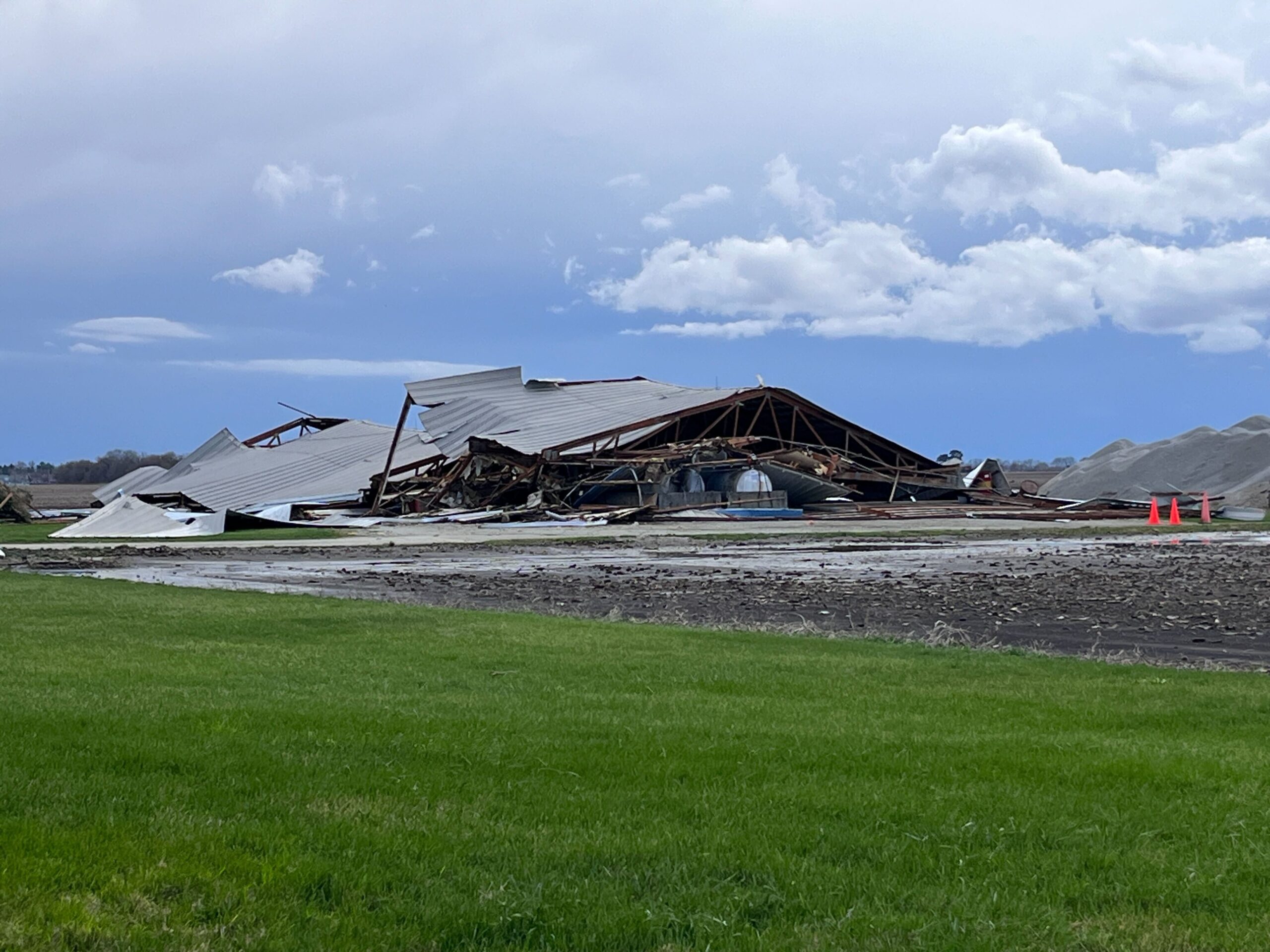
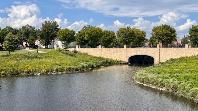
Meteorologists say the storm started in southwest Champaign County an ended south of the University of Illinois Willard Airport.
Severe storms possible Sunday afternoon and early evening.
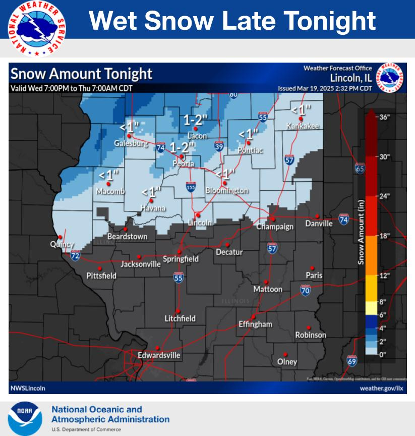
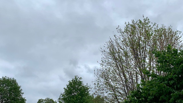
Rain showers this evening will mix with and change to snow overnight.

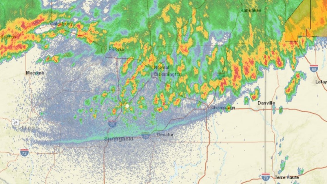
A dangerous line of thunderstorms is forecast to move through central Illinois between 8 pm and 1 am tonight. Potential hazards include 75+ mph straight-line winds, EF-2+ tornadoes, and 2″+ diameter hail.
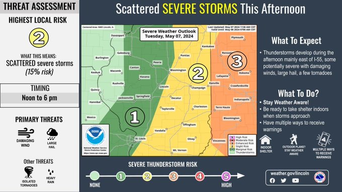
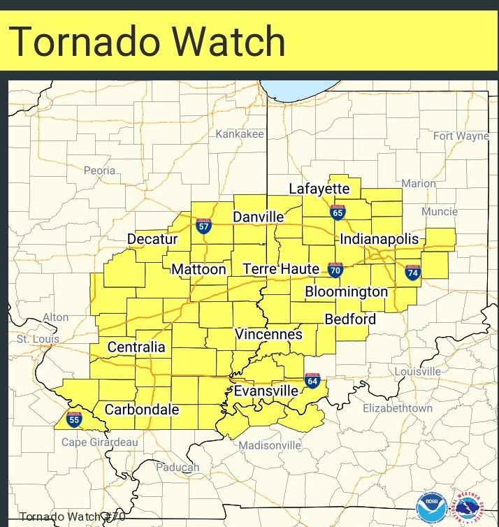
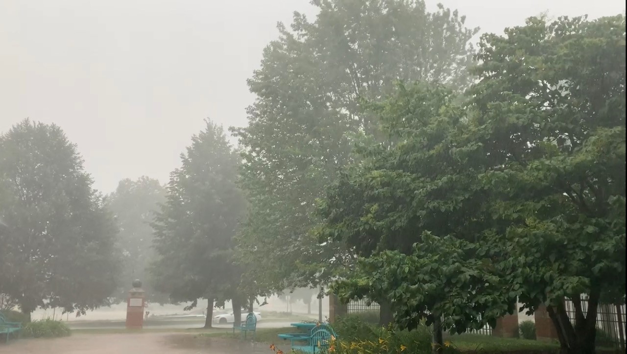
Meteorologists are forecasting two rounds of strong to severe storms crossing Central Illinois on Tuesday. Much of central Illinois has been placed under a Tornado Watch until Tuesday at 8:00 p.m. This story will be updated with new postings on X (formerly known as Twitter) from IPM meteorologist Andrew Pritchard and NWS Central Illinois. Andrew’s
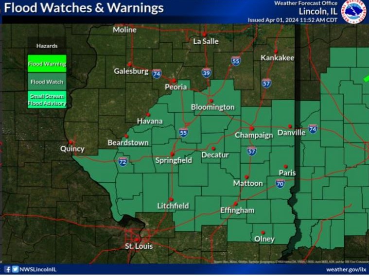
The National Weather Service in Central Illinois is tracking weather systems that will bring more than two inches of rain to our area. A flood watch is in effect until Tuesday at 1:00 p.m. Champaign, Christian, Coles, De Witt, Douglas, Macon, Piatt, Sangamon, and Vermilion Counties are included in the watch. Isolated flash flooding is
The National Weather Service in Lincoln and IPM meteorologist Andrew Pritchard are tracking the potential for severe thunderstorms, including high winds, large hail, and isolated tornadoes on Thursday.
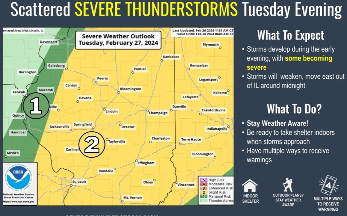
The National Weather Service in Lincoln is forecasting unseasonably warm weather on Tuesday followed by a threat of severe storms in the evening hours. Primary hazards will be damaging winds and large hail. Click below for the latest from IPM News meteorologist Andrew Pritchard and the NWS. Tweets by NWSLincolnIL
From NWS Lincoln: Labor Day features hot and humid conditions, with afternoon heat indices near 100 degrees. A few severe thunderstorms are possible Wednesday afternoon and evening.
The National Weather Service says periods of showers and thunderstorms are expected through the weekend. Highest chances will be Friday morning, and again Sunday evening.
The National Weather Service in Central Illinois is forecasting thunderstorms, some severe, late Friday into Saturday morning. Check here for the latest forecast and weather information. A special weather statement has been issued for Rantoul IL, Thomasboro IL and Gifford IL until 1:00 AM CDT pic.twitter.com/RGzXfLhe8Z — NWS Lincoln IL (@NWSLincolnIL) July 29, 2023 Sirens
The National Weather Service in Lincoln says thunderstorms are possible in Central Illinois on Thursday afternoon. [2:57 PM] The storms in Vermilion and Edgar Counties have moved into Indiana, but much of Clark County is being affected by another storm which could produce some gusty winds and small hail as it drifts slowly towards the
The National Weather Service in Lincoln says thunderstorms are possible in Central Illinois on Monday afternoon. A severe thunderstorm watch has been issued for parts of Illinois and Indiana until 12 AM EDT pic.twitter.com/jXUYDOFKRf — NWS Lincoln IL (@NWSLincolnIL) July 17, 2023 A special weather statement has been issued for Taylorville IL, Assumption IL and
The National Weather Service in Lincoln is advising people in Central Illinois to stay weather aware for high winds, heavy rain, possible tornado and heavy hail on Thursday. Tweets by NWSLincolnIL